June 29, 2017
The rocks exposed at the mouth of the Mohawk River
The City of Waterford sits at the intersection of the Hudson and Mohawk Rivers north of Albany, part of a great inland water highway that leads deep into the interior of the United States and ultimately connects the Atlantic Ocean to the Mississippi River. The Erie Canal sits on one side of the Waterford waterfront, and Lock 1 of the Champlain Canal which runs up to Canada sits to the north on the Hudson. Historically this was a busy industrial crossroads and is still used for some commercial traffic, today it’s a great place to put in a paddle boat and explore.
We weren’t interested in any of that history and greatness. It was a glorious first Sunday of summer, the sky was blue with puffy clouds, the water was warm and the weather was not too hot. The Wife and I took our friend Sandra up there to explore and show her the sights. As The Wife kept telling her, when you get into a small boat and paddle around everything looks different and you see all kinds of things you’d never see if you stayed on dry land.
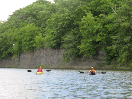 Our Friend Sandra And The Wife Rounding Peebles Island
There’s an obscure State boat launch in the Lansingburgh part of the City of Troy where we like to put in, it sits directly across the Hudson from Waterford. The launch is a bit steep going into the water, but it’s rarely too busy and there’s a convenient parking spot for our cars next to it. But when we got there a little after 10AM we saw these local fire and EMT guys down at the bottom.
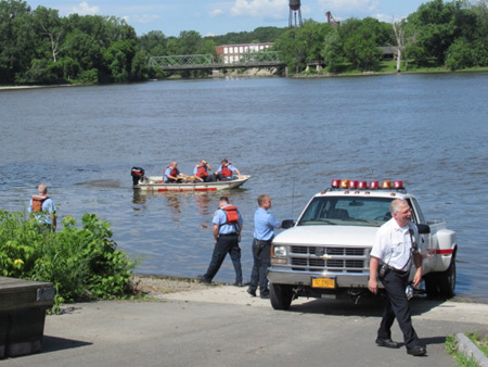 Uh Oh, This Doesn’t Look Good
Were they looking for bodies, maybe trolling for evidence? Nope, turned out they were just doing a training exercise. One of the guys in charge actually apologized to us for getting in our way. No problem, there was plenty of room for us to carry our boats down and launch, we didn’t want to get in their way. After all, they were doing something important and we weren’t.
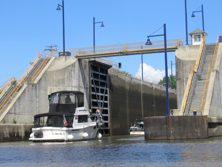 Pleasure Craft Heading Into Erie Canal Lock E-2
Our first order of business was to check out the Erie Canal Lock at the far end of the Waterford waterfront, Sandra had never seen one in operation before. She and The Wife sat a little too close as the lock was expelling water and they both bounced around in the resulting current fighting to stay in one place. When the gates opened three non-commercial craft went into the lock. Since the 1990s pleasure craft use the locks in New York State for free, and that would include our little paddle boats if we had been so inclined to head into this one.
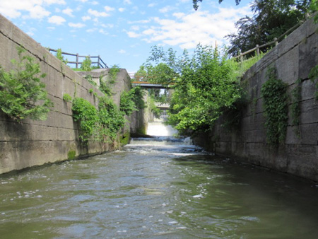 The Old Champlain Canal Lock Used Today As A Spillway
There’s an old canal lock from the 1800s built with big stone blocks that sits next to the current lock, it is still used as a water overflow. We’d always assumed that it was an old Erie or Barge Canal lock but Google Maps identifies it as part of the old Champlain Canal. Water usually rushes through it tumbling down the rock steps, but I did manage to get in close despite the roiling broiling current inside the narrow passage.
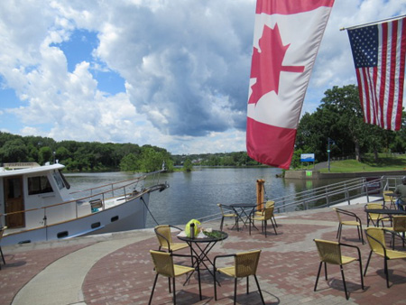 Waiting For The Ladies To Use the Restroom
So then we landed our boats at the launch which sits on the tip of the waterfront and visited the Sunday morning farmer’s market along the water’s edge, which starts at 9AM. It’s not a big market, it’s very low key but there’s some nice things for sale. We shopped a little and got some eats, then we hung out for an hour on a bench, eating and talking and looking out at the water and the islands.
 Heading Around Peebles Island
There’s a lot to see around here on a paddle boat trip, more than you can find in one day. We were thinking about landing on Peebles Island, which is now a State Park connected to Waterford by an old refurbished railroad bridge. There are walking trails, picnic greens, the old “Sanforizing” (textile shrink proofing) factory that is now a museum, and of course the remains of the Breastworks, the earthworks ordered made by General Tadeusz Kosciusko in 1777 to defend the island during the Liberal Revolution that created our nation.
But you see, we got distracted. We decided to first paddle around Peebles island, where we discovered something very interesting on the other side. It was just as well, from our vantage point it looked like the island was overrun with people. There were picnic parties, people fishing, runners on the paths and all sorts of people just wandering around. We’ll save Peebles Island for another day.
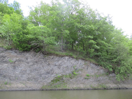 Shale Cliffs On Peebles Island
The point where we started to go around Peebles Island is officially the mouth of the Mohawk River. It doesn’t look any different from the Hudson River, particularly from a paddle boat, it’s all water. But the passage on the north side of the island gets progressively more shallow, particularly since this was low tide. (Yes, the Hudson and also the mouth of the Mohawk are affected by Atlantic Ocean tides 150 miles away, our elevation is low.)
On this north side of Peebles Island are shale cliffs that rise high straight up out of the water. There is shale all around these waterways and the flaky rock is very visible in those places where there have been few human alterations. It is layered in striations like stacks of paper crushed together, it crumbles easily into little pieces that lay at the bottoms of the cliffs as mounds of flat gravel.
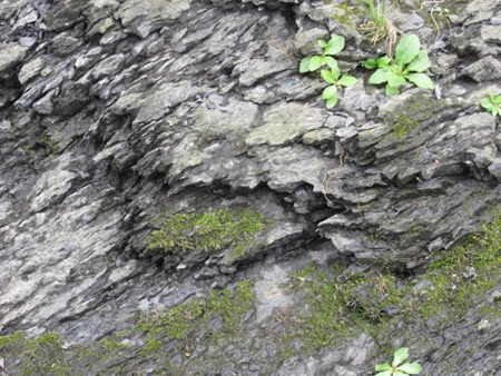 Closeup Of The Shale Cliffs On Peebles Island
Now, if you look at Peebles Island on Google Maps you would get the impression that the island is circumnavigable by boat but that’s never been true. There is a wide, flat area of shale in the water that connects Peebles Island to the north bank of the Mohawk. Beyond these shale flats is an old spillway dam, part of the elaborate set of waterworks designed to make this intersection of the rivers navigable.
Back in the day, like over 200 years ago before humans altered the landscape around here for their own convenience, one could walk across these flats, travel around Peebles Island and continue through the Hudson River to Lansingburgh near where we launched our boats earlier. Thus the name Waterford, it was where you could ford the Hudson River. You can’t do that any longer, the Hudson along here was long ago dredged out for large boats, and the spillway dam usually makes the shale flats impossible to walk on.
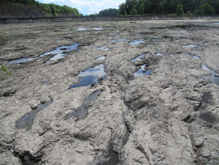 The Spillway Wasn’t Spilling
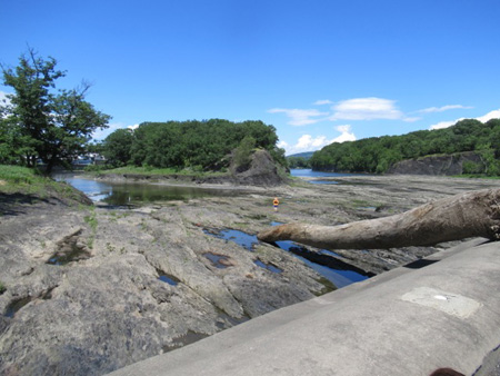
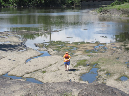
I said usually. To our surprise there was no water coming over the spillway dam and the shale flats were exposed. The flats looked amazing, the word moonscape came to our minds as we first gazed at it. But it was a moonscape with puddles of water. Imagine the Moon like that.
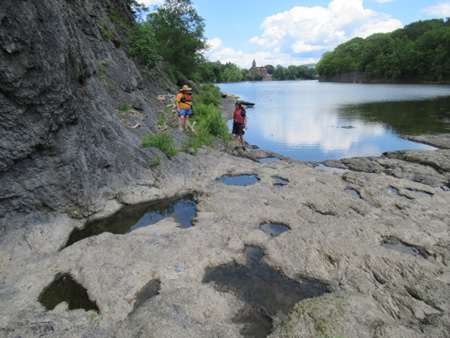 Landing On The Shale Flats
Leading the way I found a navigable channel that came up close to the flats and we landed our boats on a convenient gravel beach across from Peebles Island. It was easy to walk as long as one carefully stepped around the wet crevices.
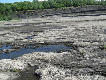 The Shale Flats
I do wonder about fording the river here several hundred years ago, these crevices would have been underwater and thus treacherous. Probably more than a few people abruptly fell in the drink and more than a few horses ended up with broken legs.
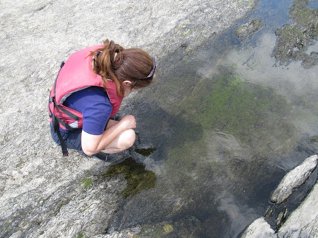 Sandra Watches Fish In A Tidal Pool
The puddles, it turned out, were tidal pools full of life that had been caught when the water stopped running over the spillway. We saw schools of small young fish that may have been pickerel and bass. There were plenty of snails with pointy shells both black and white, and small freshwater clams. And strange crawly worms that lurked in crevices.
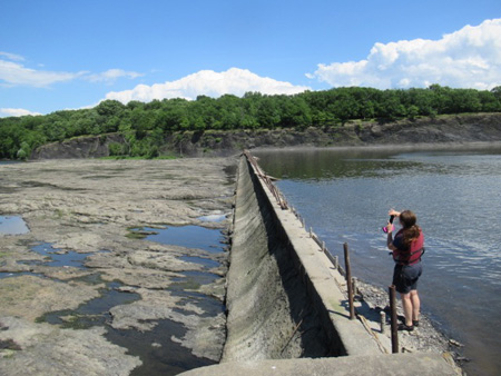 On Top Of The Spillway
Approaching the spillway the flats rise up. Sandra and I climbed up and over the dam, sure enough the water on the other side was well beneath the crest. This was the first time I’d been up there. I have to say the dam looks like it could use some maintenance, it didn’t look ready to collapse but if it did that could really screw up the hydraulics for the entire area. I’m just sayin.’
 The Wife Waits Way Down Below (The Yellow Dot In The Middle)
The Wife, who was more nervous than usual, would not climb up with us and stayed below. She alternately called up dire warnings to us about slippage and the rising tide, followed by worriedly pacing. Eventually I spotted her down below across the flats gazing happily at the scenery.
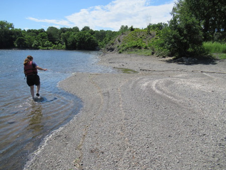 Clamshells On A Shale Beach
Meanwhile on a shale beach on the other side of the dam Sandra observed that the light colored lines on a shale beach were the shells of freshwater clams. “Something’s been eating them,” she decided, “maybe birds.” We’d been wondering if some of the bivalves we were seeing in the tidal pools were the dread zebra mussels, but apparently not. The zebras have a distinct fan shape and tend to attach themselves to objects in dense clumps.
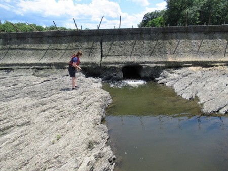 Channel Under The Spillway
Back on the dry side of the dam Sandra found a pipe in the middle of the dam that emptied a small quantity of water into a deep channel. Not sure why this is necessary, maybe to keep the water moving and fresh at low tide. Sandra excitedly pointed out some sizable fish in the channel, including a great big bass. “I should have brought my net!” she said.
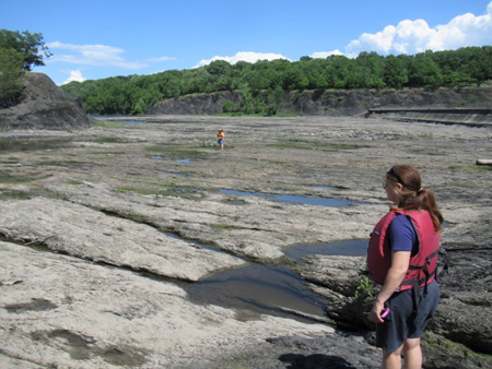 Okay, Okay, We’re Coming Back
So now it was late afternoon and the wind was picking up, so we decided to head back to the launch. After we rounded Peebles Island again the waves were fairly rough in the Hudson and we had to fight the waves for a bit. We landed and tied up our boats on our cars and went to an early dinner at Hotdog Charlie’s across the river on Route 32, little hotdogs and french fries, you know, health food. That was our day.
 The Armchair Environmentalist Caught Outdoors
 Day Before Trash Day In My Neighborhood, Holes In Can Lids Are Made By Squirrels
  Albany County Executive Dan McCoy In My Neighborhood On MLK Day 2016